East End of The Cape Cod Canal #445
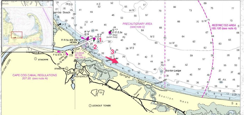
For Sake of Argument, we will refer to the waters just outside of the Cape Cod Bay end of the
Canal all the way to Sandwich Old Harbor as “The East End” This is a particularly juicy area at
tides where the water from the Canal is flushing out into Cape Cod Bay.
This is a small area that is very protected from the winds from the South which is a common
occurrence in the warmest months on Cape Cod, thus making this spot a popular on on very
windy days and short proximity from the Sandwich Boat Ramp.
Here’s a few tips to get you started:
- Surface feeding stripers and bluefish may be present along this shorefront at any point in
the season due to the proximity of the Cape Cod Canal. - If no fish are showing, cast near any of the boulders or rock shoals. Use soft plastics,
swimming lures, thin profile metals, surface plugs and flies. Watch for birds working off
outside the Canal, especially in the fall. - Troll in 10 – 15 feet of water along the shoals. Use unweighted tubes, light umbrella rigs,
swimming plugs, soft plastics. Do not troll into the Cape Cod Canal channel.
- Approx Lat & Long: 41°45.5’ N, 70°29’ W
- Best Tide: Either; action slows at slack.
- Hazards: Rocks and rocky shoals stretch about ¼ mile east of canal entrance. Large
ocean swells may be present during storms or hard east wind.
If no luck, meander over to Sandwich Old Harbor.
Sandwich Old Harbor
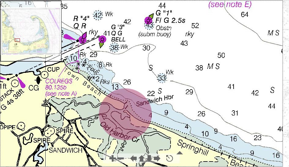
Watch for birds working over bait being swept out from the marsh and surface feeding striped
bass. Cast into the rip and allow lures to swing out of the flow. Surface poppers can be effective
in the smoother water on either side of the rip. Also use soft plastics, flies, swimming plugs, jigs,
metals, rigged eels. First light is best but fish may feed throughout the day, especially during
cloudy conditions.
When trolling, work along the drop off where the rip spreads out in 15 – 20 feet of water. Use
wire line and umbrella rigs, large soft plastics, swimming plugs, metals, rigged eels, jigs.
- Approximate Lat & Long: 41°45.2’ N, 70°28.5’ W
- Best Tide: Outgoing; action slows at slack.
- Hazards: Very rough conditions develop here when the outgoing tide from the marsh is
against the wind. Use caution in these conditions when approaching the strong rip.

